In cooperation with the CoyoteSmarts initiative for the Narragansett Bay Islands, NBCS is providing an interactive map of all coyote reports we receive. The Sightings Map will help identify coyote activity hotspots and draw attention to neighborhoods with undue coyote traffic.
 NBCS GPS-tracking has determined that “easy pickins” are almost always at the root of coyote behavior problems in neighborhoods. If you are seeing daytime coyote activity in residential areas, your neighborhood may have food attractants that reward coyotes for returning and habituate them to people (make them lose their fear).
NBCS is partnered with CoyoteSmarts and island municipalities to provide information and assistance to effectively “clean up coyote problems” by finding and removing non-natural food attractants in urban and suburban neighborhoods.Where's That Varmint?!
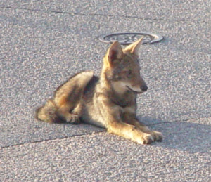
You can report your sightings – of interest or concern – with the online Sightings Form. Sightings of coyotes in the wild are always appreciated. Photos are welcomed and will be published in the NBCS “Rogue’s Gallery.” The Sightings Map will be updated monthly.
Coyote Sightings Map
This is a map of the Coyote Sightings Reports submitted to The Conservation Agency’s Narragansett Bay Coyote Study (NBCS) – uploaded October 19 2020. Since 2005 our focal study area has been two Narragansett Bay Islands in Rhode Island. NBCS uses and shares these data, along with data from GPS tracking collars, to help dentify areas where coyote-human interactions are more prevalent. The majority of the sightings are from coastal regions of of our study area where coyotes are frequently seen. Thank you for your input – we now have more than 3000 reports.
The Sightings Map is interactive: zoom in or out, pan, change the basemap to satellite imagery, or click on any sighting to see details.


